Category:Bayston Hill
Jump to navigation
Jump to search
English: Bayston Hill is a large village and civil parish in central Shropshire, England. It is south of the county town Shrewsbury and located on the main A49 Shrewsbury to Hereford Road.
village and civil parish in Shropshire, United Kingdom .jpg) | |||||
| Upload media | |||||
| Instance of | |||||
|---|---|---|---|---|---|
| Location | Shropshire, West Midlands, England | ||||
 | |||||
Media in category "Bayston Hill"
The following 149 files are in this category, out of 149 total.
-
 66 529 Sharpstones Bayston Hill Shropshire - UK, 31.5.12. (7315567362).jpg 3,888 × 2,592; 3.33 MB
-
 67 003 Bayston Hill, shropshire - UK, July 23 2012. (8212235791).jpg 3,888 × 2,592; 3.68 MB
-
 67 003 Bayston Hill, shropshire - UK, July 23 2012. (8213324926).jpg 3,888 × 2,592; 3.95 MB
-
 A bus stop at Bayston Hill - geograph.org.uk - 2119107.jpg 617 × 449; 111 KB
-
 A muddy footpath - geograph.org.uk - 404077.jpg 619 × 461; 132 KB
-

-
 A49 at Bayston Hill - geograph.org.uk - 2959757.jpg 640 × 481; 48 KB
-
 A49 at the entrance to Bayston Hill - geograph.org.uk - 3545407.jpg 640 × 480; 25 KB
-
 A49 at the junction for Condover - geograph.org.uk - 3545404.jpg 640 × 480; 25 KB
-
 A49 east of Little Lyth - geograph.org.uk - 2958337.jpg 640 × 481; 35 KB
-
 A49 Hereford Road - geograph.org.uk - 1866694.jpg 640 × 480; 67 KB
-
 A49 Hereford Road - geograph.org.uk - 1866705.jpg 640 × 480; 70 KB
-
 A49 junction with unnamed lane to Condover - geograph.org.uk - 3772573.jpg 3,419 × 2,672; 1.27 MB
-
 A49 northbound - geograph.org.uk - 4141019.jpg 640 × 479; 40 KB
-
-
 A49 vista - geograph.org.uk - 3545399.jpg 640 × 480; 25 KB
-
 A5 crosses the railway mainline - geograph.org.uk - 3709764.jpg 3,531 × 2,524; 1.48 MB
-
 A5 north of Pulley - geograph.org.uk - 3709772.jpg 3,648 × 2,736; 1.71 MB
-
 A5 overbridge carries Nobold Lane - geograph.org.uk - 3709775.jpg 3,648 × 2,736; 1.7 MB
-
-
 A5, Pulley Lane overbridge - geograph.org.uk - 3149187.jpg 640 × 430; 53 KB
-
 Allotments west of Bayston Hill - geograph.org.uk - 2784843.jpg 1,306 × 979; 298 KB
-
 Another view of The Compass Inn. - geograph.org.uk - 716384.jpg 640 × 480; 64 KB
-
-
 Barn at Bomere Farm - geograph.org.uk - 2549540.jpg 1,024 × 768; 327 KB
-

-
 Bayston Hill - Lythwood Road - geograph.org.uk - 3545417.jpg 640 × 480; 28 KB
-
 Bayston Hill - Lythwood Road - geograph.org.uk - 3545421.jpg 640 × 480; 24 KB
-
 Bayston Hill - Overdale Road - geograph.org.uk - 3545424.jpg 640 × 480; 31 KB
-
 Bayston Hill library - geograph.org.uk - 2784791.jpg 1,142 × 857; 369 KB
-
 Bayston Hill Methodist Church - geograph.org.uk - 2789592.jpg 1,142 × 857; 298 KB
-
 Bayston Hill quarry - 'A' asphalt plant - geograph.org.uk - 5087520.jpg 1,958 × 1,469; 902 KB
-
 Bayston Hill quarry - 'B' asphalt plant - geograph.org.uk - 5087527.jpg 1,632 × 1,224; 754 KB
-
 Bayston Hill quarry - Concrete plant - geograph.org.uk - 5087530.jpg 1,224 × 1,632; 613 KB
-
 Bayston Hill Quarry - geograph.org.uk - 5567501.jpg 1,024 × 683; 305 KB
-
 Bayston Hill quarry - partly restored land - geograph.org.uk - 2549507.jpg 1,152 × 864; 285 KB
-

-
 Bayston Hill road bridge over A5 - geograph.org.uk - 3798168.jpg 640 × 387; 48 KB
-
 Bench, Lyth Hill - geograph.org.uk - 1614172.jpg 640 × 480; 114 KB
-
 Bench, Lyth Hill - geograph.org.uk - 1614189.jpg 640 × 480; 83 KB
-
 Berries Lane, Bayston Hill (geograph 409901).jpg 600 × 600; 91 KB
-
 Burger King, Pulley Services - geograph.org.uk - 4110610.jpg 1,024 × 787; 136 KB
-
 Bus stop on A49 at the north of Bayston Hill - geograph.org.uk - 5591413.jpg 1,600 × 1,067; 652 KB
-
 Carpark - Lyth Hill country park - geograph.org.uk - 3469473.jpg 1,306 × 979; 453 KB
-
 Christ Church, Bayston Hill - geograph.org.uk - 2784804.jpg 1,142 × 857; 308 KB
-
 Christ Church, Bayston Hill - geograph.org.uk - 6088505.jpg 1,958 × 2,611; 1.85 MB
-
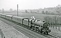
 Condover Southbound freight approaching geograph-2773421-by-Ben-Brooksbank.jpg 2,392 × 1,447; 1.65 MB
-
 Crags, Lyth Hill - geograph.org.uk - 1614201.jpg 640 × 480; 106 KB
-
 Crop field, Bayston Hill - geograph.org.uk - 6112568.jpg 640 × 469; 72 KB
-
 Cross Roads, Bayston Hill - geograph.org.uk - 1866733.jpg 640 × 480; 86 KB
-
 Crossroads in Bayston Hill - geograph.org.uk - 2784812.jpg 1,306 × 979; 330 KB
-
 Curving north on the A49 - geograph.org.uk - 3545398.jpg 640 × 480; 27 KB
-
 Dobbie's Garden Centre - geograph.org.uk - 2630462.jpg 640 × 480; 115 KB
-
 Dobbies Garden Centre, Shrewsbury - geograph.org.uk - 2039733.jpg 640 × 480; 70 KB
-
 Dobbies Garden World - geograph.org.uk - 1327315.jpg 640 × 480; 119 KB
-
 Dobbies Garden World at Bayston Hill - geograph.org.uk - 2671075.jpg 800 × 600; 418 KB
-
 Dobbies Garden World entrance - geograph.org.uk - 1327316.jpg 640 × 480; 80 KB
-
 East of Shrewsbury - geograph.org.uk - 2107458.jpg 2,048 × 1,536; 1.32 MB
-
 Eric Lock Road West - geograph.org.uk - 628762.jpg 640 × 480; 66 KB
-
 Esso garage at Shrewsbury Services - geograph.org.uk - 5504431.jpg 480 × 640; 63 KB
-
 EWS 6V75 Dee Marsh-Margam steel empties passing Bayston Hill, Salop.jpg 2,445 × 1,861; 956 KB
-
 Farmland by the A5 - geograph.org.uk - 3145905.jpg 640 × 430; 57 KB
-
 Farmland by the Shrewsbury bypass - geograph.org.uk - 3145907.jpg 640 × 430; 53 KB
-
 Farmland south of Bayston Hill - geograph.org.uk - 6088546.jpg 1,469 × 1,102; 584 KB
-
 Fields at Bayston Hill - geograph.org.uk - 3663857.jpg 1,500 × 1,000; 1.21 MB
-
 Fields with distant hills, south of Bayston Hill - geograph.org.uk - 5591423.jpg 1,600 × 1,144; 656 KB
-

-
 Footpath near Bomere Farm - geograph.org.uk - 2549546.jpg 1,152 × 864; 289 KB
-
 Footpath to Bomere Farm at Bayston Hill, Shropshire, England.jpg 640 × 480; 47 KB
-
 Gate with a view - geograph.org.uk - 6265183.jpg 5,184 × 3,888; 4.46 MB
-
 Glebe Road, Bayston Hill - geograph.org.uk - 1526863.jpg 640 × 480; 81 KB
-
 Hereford Road, near Bayston Hill - geograph.org.uk - 4142007.jpg 3,488 × 2,616; 2.16 MB
-
 It's getting busy on the bypass - geograph.org.uk - 2110527.jpg 640 × 480; 91 KB
-
 Junction at Bayston Hill - geograph.org.uk - 2285251.jpg 640 × 480; 43 KB
-
 Lane past Lyth Hill reservoir - geograph.org.uk - 2119099.jpg 640 × 480; 126 KB
-
 Lay-by beside the A49 in 1987 - geograph.org.uk - 2981011.jpg 710 × 500; 97 KB
-
 Loading an 8-wheeler - geograph.org.uk - 2549502.jpg 1,152 × 864; 303 KB
-
 Looking north towards Bayston Hill - geograph.org.uk - 6088547.jpg 1,469 × 1,102; 492 KB
-

-
 Lower Pulley Lane - geograph.org.uk - 5087537.jpg 1,306 × 979; 669 KB
-
 Lyth Farm - geograph.org.uk - 3469486.jpg 1,044 × 783; 434 KB
-
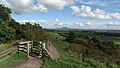
 Lyth Hill country park - geograph.org.uk - 3469481.jpg 1,306 × 979; 389 KB
-
 Lyth Hill Road - geograph.org.uk - 1526880.jpg 640 × 480; 96 KB
-
 Lyth Hill Road, Bayston Hill - geograph.org.uk - 1526859.jpg 640 × 480; 93 KB
-
 Lyth Hill Road, Bayston Hill - geograph.org.uk - 4141995.jpg 3,488 × 2,616; 2.16 MB
-
 Missing (in action^) and now relocated - geograph.org.uk - 2783584.jpg 1,142 × 857; 351 KB
-
 Motel Rabbit - geograph.org.uk - 4512062.jpg 800 × 600; 159 KB
-
 Motel View - geograph.org.uk - 4512052.jpg 800 × 600; 85 KB
-
 New-build housing at Bayston Hill - geograph.org.uk - 2787729.jpg 1,403 × 1,052; 332 KB
-
 Northbound train - geograph.org.uk - 615934.jpg 600 × 400; 39 KB
-
-

-
 OS benchmark - Bayston Hill, Lower Pulley Farm - geograph.org.uk - 5087550.jpg 979 × 1,306; 701 KB
-
 OS flush bracket 2880 - Upper Pulley - geograph.org.uk - 4569406.jpg 857 × 1,142; 522 KB
-

-
 Path along the top of Lyth Hill - geograph.org.uk - 3469488.jpg 1,142 × 857; 377 KB
-
 Path, Lyth Hill - geograph.org.uk - 1614194.jpg 640 × 480; 132 KB
-
 Pulley Hall barn conversions - geograph.org.uk - 5087538.jpg 1,469 × 1,102; 620 KB
-

-

-
 Pulley Lane leaves Baystone Hill - geograph.org.uk - 3545430.jpg 640 × 480; 33 KB
-
 Railway south from bypass - geograph.org.uk - 1877018.jpg 640 × 480; 57 KB
-
 Recent tree plantings near Bayston Hill - geograph.org.uk - 2784850.jpg 1,142 × 857; 259 KB
-
 Road junction in Bayston Hill - geograph.org.uk - 2789576.jpg 1,306 × 979; 294 KB
-
 Services Road - geograph.org.uk - 4512043.jpg 800 × 600; 83 KB
-
 Shops and flats in Bayston Hill - geograph.org.uk - 5205110.jpg 640 × 480; 74 KB
-
 Shrewsbury By-pass - geograph.org.uk - 2994867.jpg 4,288 × 3,216; 2.72 MB
-

-

-

-
-

-
 Shrewsbury Services - geograph.org.uk - 2903917.jpg 640 × 426; 57 KB
-
 Stone processing plant at Bayston Hill quarry - geograph.org.uk - 2549539.jpg 1,152 × 864; 279 KB
-
-
 The A5 at the Bayston Hill roundabout - geograph.org.uk - 3526039.jpg 2,592 × 1,936; 1.33 MB
-
 The Common in Bayston Hill - geograph.org.uk - 6088506.jpg 1,469 × 1,102; 715 KB
-
 The Common, Bayston Hill - geograph.org.uk - 5591420.jpg 1,600 × 1,200; 722 KB
-
 The Common, Bayston Hill - geograph.org.uk - 878528.jpg 640 × 480; 84 KB
-

-
-

-
 The Compasses Inn, Bayston Hill - geograph.org.uk - 1866743.jpg 640 × 480; 64 KB
-
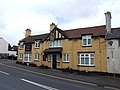
 The Compasses Inn, Bayston Hill - geograph.org.uk - 409858.jpg 640 × 480; 88 KB
-
 The Compasses Inn, Bayston Hill - geograph.org.uk - 4141979.jpg 3,488 × 2,616; 2.17 MB
-

-
-
 The old Pulley Lane - geograph.org.uk - 5107917.jpg 1,102 × 1,469; 626 KB
-
 The Three Fishes at Bayston Hill - geograph.org.uk - 3663840.jpg 1,000 × 1,500; 1.14 MB
-
 The Three Fishes pub, Bayston Hill - geograph.org.uk - 3952454.jpg 4,320 × 3,240; 2.94 MB
-
 Third of three signs at view point on Lyth Hill - geograph.org.uk - 2070568.jpg 2,848 × 2,136; 1.53 MB
-
 Three Fishes (1), Hereford Road, Bayston Hill - geograph.org.uk - 2821156.jpg 1,024 × 657; 162 KB
-

-
 Three Fishes - Bayston Hill - geograph.org.uk - 4862143.jpg 3,067 × 2,486; 1.04 MB
-
 Three Fishes, Bayston Hill - geograph.org.uk - 4141969.jpg 3,488 × 2,616; 2.15 MB
-
 Under The Burgs - geograph.org.uk - 5567504.jpg 1,024 × 683; 271 KB
-
 Used car vendor, Bayston Hill - geograph.org.uk - 5591416.jpg 1,600 × 1,065; 664 KB
-
 View towards Lyth Hill - geograph.org.uk - 6088556.jpg 1,306 × 979; 527 KB
-
 View towards The Wrekin from Lyth Hill, Shropshire - geograph.org.uk - 5620362.jpg 5,184 × 2,920; 5.42 MB
-
-
 Bayston Hill Quarry - geograph.org.uk - 723401.jpg 640 × 480; 79 KB
-
 Christmas Turkey - geograph.org.uk - 644827.jpg 640 × 426; 40 KB
-
 Cound Brook Ford - geograph.org.uk - 723406.jpg 640 × 480; 112 KB
-
 Entrance to Bayston Hill Quarry - geograph.org.uk - 723400.jpg 640 × 480; 91 KB
-
 Glebe Road, Bayston Hill - geograph.org.uk - 628761.jpg 640 × 480; 56 KB
-
 Hook-a-gate - geograph.org.uk - 419621.jpg 640 × 480; 97 KB
-
 Lane to Bayston Farm. - geograph.org.uk - 716393.jpg 640 × 480; 78 KB
-
 Lythbank - geograph.org.uk - 628774.jpg 640 × 480; 74 KB
-
 Turnips^ - geograph.org.uk - 404074.jpg 626 × 449; 153 KB
.jpg)
.jpg)
.jpg)


_and_now_relocated_-_geograph.org.uk_-_2783584.jpg)


,_Hereford_Road,_Bayston_Hill_-_geograph.org.uk_-_2821214.jpg)
,_Hereford_Road,_Bayston_Hill_-_geograph.org.uk_-_2821247.jpg)
_-_sign,_Hereford_Road,_Bayston_Hill_-_geograph.org.uk_-_2821287.jpg)


,_Lyth_Hill_Road,_Bayston_Hill_-_geograph.org.uk_-_2821108.jpg)
,_Lyth_Hill_Road,_Bayston_Hill_-_geograph.org.uk_-_2821127.jpg)


,_Hereford_Road,_Bayston_Hill_-_geograph.org.uk_-_2821156.jpg)
_-_sign,_Hereford_Road,_Bayston_Hill_-_geograph.org.uk_-_2821185.jpg)


